Section outline
-
-
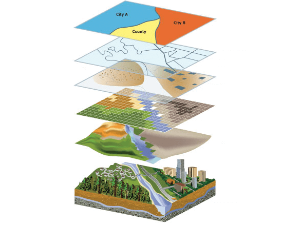
The course provides a broad introduction to the methods of representing the real world and the models used for storing geospatial information.
-
Spatial data analysis is an old and vast field that brings together many methodologies, some general and others more specific to a specific thematic field.
-
-